Model Card for granite-geospatial-uki
>>Try it on Colab<< (Please select T4 runtime)
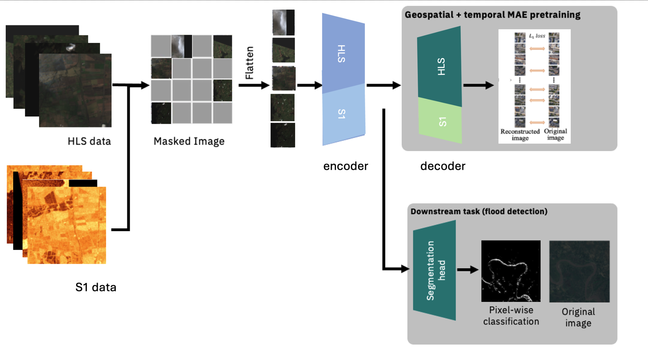
The granite-geospatial-uki model is a transformer-based geospatial foundation model trained on HLS L30 multispectral satellite imagery and Sentinel-1 synthetic aperture radar (SAR) backscatter over the United Kingdom and Ireland. The model consists of a self-supervised encoder developed with a ViT architecture and Masked AutoEncoder (MAE) learning strategy, with an MSE loss function and follows the same architecture as Prithvi-EO.

How to Get Started with the Model
An example of fine-tuning the model for image segmentation using Terratorch for flood detection in the UK and Ireland can be found here.
Pre-training
The granite-geospatial-uki model uses the Prithvi-EO model architecture. It was pre-trained on HLS data for the continental USA, followed by additional pre-training using 16,000 HLS L30 and Sentinel-1 images covering the United Kingdom and Ireland. The Sentinel-1 SAR backscatter were resampled to the same resolution as the HLS data, and were normalized by , where pixels with are set to and are set to . The two additional Sentinel-1 bands were initialized with the mean weights of the other channels for pre-training. The following bands were used in the pre-trained model:
- Blue
- Green
- Red
- Narrow NIR
- SWIR 1
- SWIR 2
- VV
- VH
Model Card Authors
Geoffrey Dawson, Chris Dearden, Andrew Taylor, Helen Tamura-Wicks, Anne Jones & Paolo Fraccaro.
Acknowledgments
This work was supported by the Hartree National Centre for Digital Innovation, a collaboration between STFC and IBM.
IBM Public Repository Disclosure:
All content in this repository including code has been provided by IBM under the associated open source software license and IBM is under no obligation to provide enhancements, updates, or support. IBM developers produced this code as an open source project (not as an IBM product), and IBM makes no assertions as to the level of quality nor security, and will not be maintaining this code going forward.
- Downloads last month
- 211